

Automating Deforestation Detection with Geospatial AI (LULC)

AI Summary & Key Answer
#NowForClimate: Automating Deforestation Detection with Geospatial AI (LULC) body { font-family: -apple-system, BlinkMacSystemFont, "Segoe UI", Roboto, Helvetic...
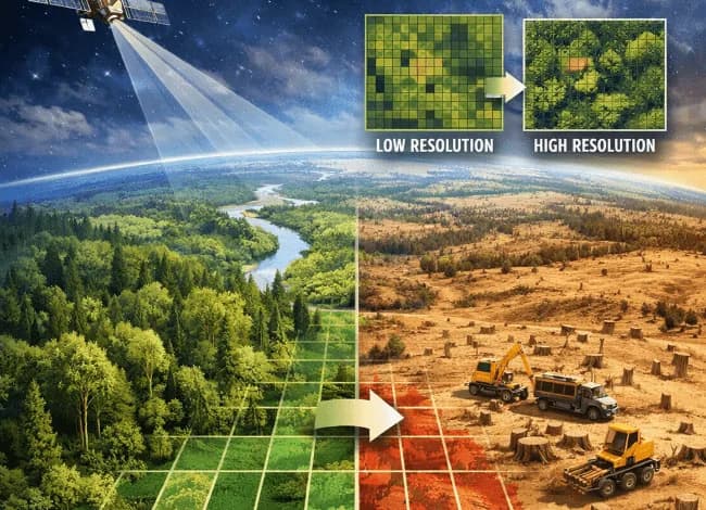
Today is World Environment Day. While global leaders discuss macro-level policy, the practical engineering challenge remains critical: How do we accurately measure and audit ecosystem change at scale?
Traditional, manual GIS interpretation of satellite imagery is fundamentally slow, expensive, and reactive. We cannot manage what we cannot measure quickly. To achieve the immediate goals of the UN's "Inspired by Nature" theme for 2026, we need automated, zero-latency verification engines.
This post outlines the end-to-end system architecture for building a robust, production-grade automated Land Use / Land Cover (LULC) change detection pipeline. This system converts high-resolution raw satellite data into actionable environmental intelligence.
The System Architecture Overview
Building an automated LULC pipeline requires integrating four complex domains: remote sensing, computer vision, data engineering, and spatial indexing.
We can visualize the entire engineering workflow in three critical phases:
- Ingestion & Normalization: Preparing raw multispectral data.
- The Segmentation Stack: The neural engine that classifies the pixels.
- Spatial Storage & Analysis: Making the results queryable.
 Figure 1: The architectural workflow for automated geospatial change detection.
Phase 1: Ingestion, Geometry, and the Cloud Problem
We ingest raw, multi-band imagery. For regional monitoring, platforms like Sentinel-2 (ESA) or high-resolution regional remote sensing satellites (like the LISS-IV sensor) are ideal. These sensors provide the necessary spectral resolution (including Near-Infrared and Short-Wave Infrared bands) to distinguish sparse vegetation from dense canopy cover.
Normalizing the Signal
Raw data is inherently noisy. Images arrive in different geometric projections and contain varying atmospheric scattering. Our first task is geometric normalization—orthorectifying the data so every pixel precisely aligns with its exact coordinates on Earth, regardless of the capture angle.
The Bitmask Fix for Clouds
The primary enemy of optical remote sensing is cloud cover. We cannot pass a cloudy image directly to a machine learning model; it corrupts the spectral values and destroys semantic accuracy.
We implement an explicit preprocessing step to generate a cloud mask. By parsing the specialized Quality Assurance (QA) bands (e.g., the QA60 band on Sentinel-2), we apply a bitmask algorithm (filtering out specific integer values that indicate 'cloud' or 'cirrus') to generate a zero/one mask. The clear pixels (the ones) are passed through, while cloudy areas are discarded or 'filled' using temporal compositing from recent clear passes.
Figure 2: The preprocessing pipeline: Converting corrupted raw data into clean, model-ready imagery via QA band bitmask analysis. Note the precise preservation of forest boundaries despite initial cloud contamination.
Phase 2: The Segmentation Stack (U-Net Architecture)
Once we have clean, georeferenced imagery arrays (GeoTIFFs), we pass them to our core segmentation engine. For dense pixel classification (segmenting an entire landscape into water, forest, agricultural land, and urban areas), we utilize a U-Net deep learning architecture.
Why U-Net?
LULC mapping requires extreme spatial precision. When segmenting urban encroachment into a protected forest, missing the boundary by even one pixel (e.g., 10 meters) is an unacceptable error. U-Net excels at this because of its symmetrical encoder-decoder structure and skip connections:
- The Encoder: The network downsamples the image, contracting the spatial information but extracting high-level semantic features (e.g., 'this pattern is a dense forest canopy').
- The Decoder: The network then upsamples, expanding the spatial dimensions back to the original resolution.
- Skip Connections: Crucially, the decoder concatenates the high-resolution features (fine edges, precise geometry) from the encoder directly into the upsampling layers.
This architecture ensures the final LULC mask respects the sharp boundaries found in the original imagery, directly addressing the precision requirements of nature-based solutions.
Phase 3: Spatial Storage & PostGIS Analytics
The output of the U-Net is a raster mask—a grid of integers corresponding to class labels. While visually useful, this is computationally dead. You cannot easily query a raw raster to ask, "How many hectares of 'Forest' class overlap with this specific administrative boundary polygon?" This is where data engineering creates value.
Vectorization and Indexing
We vectorize the classification raster, converting pixel groupings into high-precision polygons. These polygons (GeoJSON layers) are then loaded into a PostgreSQL database optimized with the PostGIS extension, which allows us to treat geography as a native data type.
The Low-Level Optimization: GIST Indexing
This is the key performance bottleneck for environmental auditing at scale: Spatial Joins. If we are monitoring a large region, our database may contain millions of LULC polygons. Calculating how they interact with legal boundaries in real-time is computationally brutal.
To solve this, we rely heavily on explicit GIST (Generalized Search Tree) spatial indexing. A GIST index does not index the complex geometry of the polygon itself, but rather its Bounding Box (the minimal rectangle that encloses the shape). When we run an intersection query, the database first uses the fast GIST index to find all potential candidates whose bounding boxes overlap. It only performs the complex, boundary-exact math on the tiny subset of polygons that pass this 'rough' filter.
Conclusion
Automating ecosystem measurement is an engineering challenge. By building a precise LULC pipeline—one that tackles cloud masking, leverages U-Net for spatial boundary preservation, and optimizes PostGIS with GIST indexing—we move from reactive observation to proactive, near-real-time environmental auditing.
If we want to protect the planet #NowForClimate, we must build the intelligent spatial infrastructure to monitor it.
Glossary of Key Terms
Experience, Expertise, Authoritativeness, and Trustworthiness. A search engine rating concept to evaluate content quality and citation reliability.
The engineering of hardware and software solutions to handle localized linguistic structures, character encodings, and regional dialects.
Cite this Article
TRENDINGS, A. (2026, June 5). Automating Deforestation Detection with Geospatial AI (LULC). Aajori Lab Journal. Retrieved from https://aajori.in/blog/145777086262048688/automating-deforestation-detection-with
Frequently Asked Questions
AAJORI TRENDINGS
Technical Contributor
Expert author writing on regional AI technologies, localized software engineering, and digital transformation for Aajori Private Limited.